GULF RECON
Nature Coast - Regional Zone
Nature Coast - Regional Zone
Couldn't load pickup availability
310 Curated Offshore Waypoints (0–60 Miles)
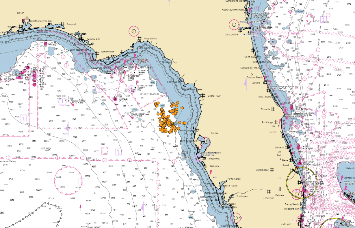
Cedar Key to Tarpon Springs
Powered by Gulf Recon Scoring Intelligence
The Nature Coast Regional Zone delivers 310 professionally curated fishing waypoints covering waters from Cedar Key south to Tarpon Springs, extending from the coastline out to approximately 60 miles offshore.
This stretch of Florida’s Gulf Coast is known for expansive hard bottom, subtle relief changes, ledge transitions, and productive offshore structure. The Nature Coast fishery rewards anglers who understand bottom composition and structure patterns — and this package is built to help you focus on higher-probability areas within it.
This is not a random waypoint list. Every coordinate has been refined and ranked using the proprietary Gulf Recon Scoring System, engineered to evaluate structural quality, historical activity indicators, and uniqueness within surrounding bottom.
What’s Included
✔ 310 Professionally Scored Waypoints (0–60 miles offshore)
✔ .GPX and .USR Files – Compatible with Garmin, Simrad, Lowrance, Raymarine & most major chartplotters
✔ Download Instruction PDF – Clear step-by-step import guide
✔ Clean, organized, ready-to-load file structure
Share