Skip to product information
1 of 2

GULF RECON

Pulley Ridge Fishing Spots & GPS Waypoints

Pulley Ridge Fishing Spots & GPS Waypoints

Regular price $199.99 USD
Regular price Sale price $199.99 USD
Sale Sold out
Quantity

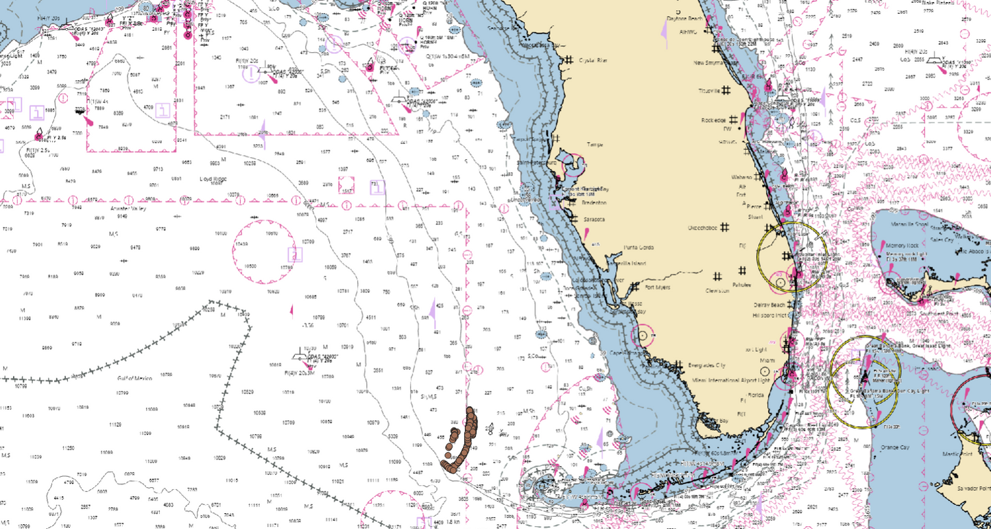
Pulley Ridge is one of the most unique offshore fishing areas in the eastern Gulf, known for deep-water reef habitat, hard-bottom transitions, ridges and complex offshore structure.

The Gulf Recon Pulley Ridge Collection was built for serious offshore anglers who want more than a massive file of unorganized fishing numbers.

Gulf Recon researches, organizes and ranks offshore structure using Recon Score™, helping anglers prioritize locations worth investigating before committing the fuel and time required for a long-range Pulley Ridge trip.

Research the Structure — Not Just the Numbers

Buying more GPS numbers isn't necessarily better.

A chartplotter loaded with thousands of unorganized waypoints can leave you with the same problem you started with: deciding where to fish.

Gulf Recon takes a different approach.

Locations are researched, categorized and ranked to create a manageable offshore intelligence package designed around quality, structure and exploration — not simply waypoint quantity.

What You'll Find

The Pulley Ridge collection focuses on offshore features including:

  • Deep-water ledges
  • Reef structure
  • Hard-bottom transitions
  • High-relief bottom
  • Wreck and artificial structure where identified
  • Other potentially productive offshore features

Each location is organized so you can evaluate your options before and during an offshore trip.

Powered by Recon Score™

Not every offshore coordinate deserves the same attention.

Recon Score™ is Gulf Recon's proprietary scoring system designed to help differentiate locations based on the available intelligence surrounding each feature.

Instead of treating every waypoint equally, Recon Score gives you another layer of information when deciding which locations deserve investigation.

Built for Pulley Ridge Exploration

Pulley Ridge isn't an ordinary nearshore fishing area.

Long distances, deep water and the sheer size of the region make trip planning important. Gulf Recon gives anglers an organized starting point for exploring the area's offshore structure without cluttering their chartplotter with an enormous unfiltered database.

Chartplotter Ready

Your purchase includes organized digital waypoint files designed for use with major marine electronics platforms, including:

  • Garmin
  • Simrad
  • Lowrance
  • Raymarine
  • Other compatible chartplotters

GPX and USR files are included, along with step-by-step download and import instructions.

Instant Digital Delivery

No physical product needs to be shipped.

After purchase, download your Gulf Recon files and prepare them for your compatible chartplotter before your next offshore trip.

What's Included

  • Curated Pulley Ridge offshore waypoint collection
  • Recon Score™ intelligence
  • Organized waypoint naming and structure
  • GPX file
  • USR file
  • Waypoint reference material
  • Step-by-step import instructions
  • Instant digital access

Why Gulf Recon?

Other products can give you more numbers. Gulf Recon is designed to give you better intelligence about the numbers you have.

Our goal isn't to fill every available slot on your chartplotter.

It's to give serious offshore anglers an organized, researched and ranked collection of structure they can explore.

Research the structure. Plan the run. Go explore.

View full details